ex post facto blog
 many miles and several months separate us from the scorching deserts of baja and the even less hospitable labor day scene that raged in rosarito and tijuana, but we now have the composure to relate the tales of our re-entry into the states and the final leg of our spin home from belize.
we realize it has been too long since our last posting—so long that we nearly aborted the blog altogether in fear of our lost spontaneity (and of the idea that people just don’t care anymore). but it would be a shame not to share our last month, the part of our ride that featured reunions with friends and family along the way. an even greater shame would be to end our story on our last posting, which reported us incapacitated by parasites and scorpions. so, in the spirit of keeping the journey alive (as we believe a trip like this will never fully leave our systems), we continue
 the story, post facto.
 ensenada
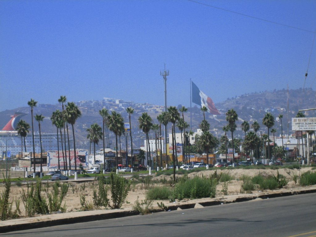
if you recall, we arrived in ensenada aboard the truck of two coffee-fiend environmental scientists who, after their java fix, raced us north and dropped us at a bike shop in ensenada. abby officially ended her dependency on the french with their unreliable presta valves and she had her bike rims drilled to accommodate schrader valves.
we celebrated her revolution with a tour of ensenada’s finest eateries and for 2 days we gorged on shrimp  and fish tacos at various streetside stands, located far from the gringo labor day debauchery and the “papas and beer"-style venues.
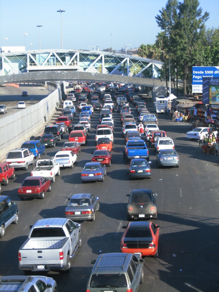
if ever there was something we didn’t plan for—and would have planned against—it was labor day weekend in baja california. part of our plan to cycle home was to avoid culture shock and ease our re-entry into the states, but as we left ensenada, it was obvious that our transition was not going to go as planned.
after 3 weeks in the desert, farther removed from civilization than we had ever been during these last several years, we suddenly found ourselves pitted against throngs of underage drinkers who had flooded baja for what looked to be a major binge session. if the infestation of drunk americans and huge ATV dune monsters weren’t enough to prove our proximity to the border, the massive billboards advertising, in english, real estate and mortgage rates were a pretty sure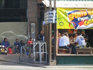 tip-off.
rosarito
in rosarito we made our way through bumper-to-bumper traffic to a hostel, crawling, literally, with the young and wasted. we arrived on the scene exhausted from a day of high-speed traffic and disheveled in our own way. the hostel manager somehow sensed we were out of our element amongst the celebrants and he offered to let us camp in the backyard.
we had been warned about the traffic at the border so the next day, labor day monday, we woke before the sun to get a headstart on the exodus. at 5am, as we cooked breakfast in the hostel kitchen, we were assumed for having the munchies and were twice offered a smoke with our oatmeal. it was one of our last mornings in mexico and, tired of being critical, we decided to accept the hilarity of our mexican-american surroundings and allow ourselves one more day abroad, in the city of tijuana.
we left rosarito and made our way 30 miles north, to the city limits of tijuana. the quiet hwy-1 we had traveled for hundreds of miles south of ensenada had now turned ugly, I-5-at-its-worst ugly: 4-lanes of high-speed traffic and at twice the volume, with both mexican morning rush hour and labor day traffic to contend with. on a steep road at the highway split for tijuana/san diego, bridget blew out her de-railer, halting her on the shoulder. abby, in a truly macgyver moment, surveyed the roadside debris for a quick fix that would get the bike moving the last 3 miles into the city center. sifting among the usual animal carcasses, beer bottles and car parts, she found a chunk of styrofoam, which she shoved between the de-railer and the frame to keep the chain in place. there’s never a dull moment cycling I-5…
tijuana
relieved that we had made it into tijuana and applauding ourselves for postponing our border crossing until after labor day, we indulged ourselves in our new favorite pasttime since finishing our time as volunteers—a trip to the grocery store. on tuesday, sept. 4., we followed the street signs marked “USA” and found the mile-long line for pedestrians waiting at the most trafficked border in the world. we stood as the lone gringos crossing on foot. two hour later, on the other side of immigration, we stayed the course with the foot traffic, which officially ended at the water fountains where, for the first time in years (and much to the chagrin of our intestinal amoebae) we drank free and potable water.
the other side
for all our planning and pedal strokes, our arrival in the states was highly anti-climatic, and except for the water fountains, english speakers, smooth roads and many obvious signs of wealth, things didn’t feel so different on the other side. but they surely were easier. after the stress of traffic and crowds between ensenada and tijuana, the ride to san diego on suburban side streets was as easy as if we were back to the days of cruising around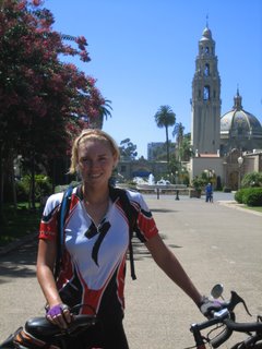 dangriga. but there was one major change to cycling in the states—bike lanes, clearly marked, wide lanes that not only entitled us to a piece of the road but actually lent legitimacy and normalcy to our passage. not only that, but now we were beginning the pacific coast highway, a popular route for other touring cyclists. suddenly the stress of blazing our own trail, as we had done in mainland mexico, or staking our claim on skinny, shoulderless roads, as in baja, was lifted, and all we had to do, it seemed, was follow the bike route signs…
san diego
san diego is exceptionally bike friendly and we spent our first midday back in the states touring around the beautiful city, which included stops at balboa park, the san diego harbor and broadway pier where the USS midway is moored, and, of course, the grocery store (twice). during the afternoon we made our way north towards mission bay, taking a route that alternated between the oceanfront path and the main drag, both lined in true california style with shops, cafes, and barefoot surfers.

we stopped at a bike shop and bridget walked out with a new gear-shifter and working de-railer, all in under 10 minutes and free of charge. and, thanks to the directions and maps provided by two gas station cashiers, we had no problem finding our way to the home of tina and ray, who, through extended family, generously offered to put us up.
our first day back in the states was almost too easy and pleasant to be true. our hardest challenge might have been the steep approach to tina and ray’s, whose beautiful home is perched high in the pacifica hills, overlooking mission bay and san diego beyond. the uphill climb (which we pushed our bikes up) was a small price to pay for a night of indoor comfort, labor day bbq, and an amazing view. thank you, tina and ray for your hospitality—and at such short notice!
san diego to laguna beach (106 miles)
the comforts of waking indoors (and to an unexpected flat tire) cost us an early departure from pacifica, but we were well rested, well fed, and excited for our next destination in laguna beach, where we were expected by some of bridget’s extended family. the first half of our ride was right on the ocean and paralleling long stretches of state beaches, a route which only left the water to pass through small coastal towns with names like oceanside. for the second day in a row, california continued to prove itself to be a grown-up’s playground and everywhere surfers, runners, and cyclists frolicked in the warm sunny weather.
“we totally fit in,” declared abby. “no one here has a job, either.”
by midday, however, we had approached a different sort of playground as we came up on the boundaries of camp pendleton, the largest military base in the united states. we stopped at a security checkpoint, showed our passports, and were allowed into the premises with verbal directions on how to get through to the other side. miles later, the road veering curiously eastward and into the barren mountains, we were making our wrong way deep into the heart of the base. civilian traffic was now outnumbered by camouflage jeeps and massive tanks, and military operations were being exercised in the distant hillsides. but we just kept on riding, wrongly assuming that if we were trespassing on secure territory of the US military which is currently at war, then surely some man in uniform would have stopped us by now. almost an hour later, putting it all together (the tanks, the helicopters, the wounded soldiers), we turned around to face a strong headwind and battled our way out of camp pendleton. in all, the navigational error cost us nearly two hours and by the time we left the premises our legs were definitely worse for the wear.
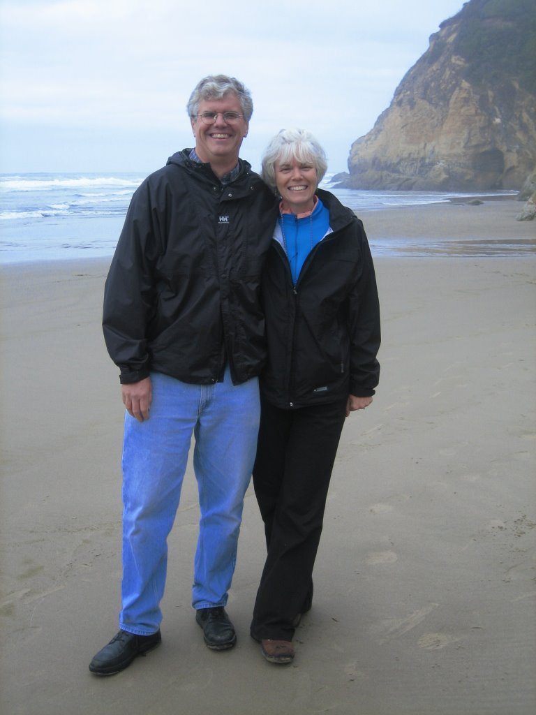
we were three more hours in the saddle when we finally rode up to the yelich’s beautiful beach house in laguna beach, where bridget’s uncle bill, bill’s cousin chris, and chris’s daughter amanda all greeted us, slightly gaping as if to say “you really are doing this on bike.” the ride to laguna beach was our longest of the entire trip, but our time in laguna beach was also our most restful (and indulgent). for 2 days we did little else than watch the US open, walk the strip in laguna beach, listen to the seals, and eat all of the haagen das in the yelich’s freezer. thanks, bill, for taking the time to drive up from san diego. and to chris and angela—we can’t thank you enough for your hospitality and generosity (and your ice cream inventory).
laguna beach to west hollywood, los angeles (60 miles)
normally, getting back on our bikes after several days such as they were spent in laguna beach (eating, not moving) would have been an arduous undertaking, but our ride to west hollywood was so fast and so easy and so uncommonly flat—flat like nebraska and flat unlike anything we had cycled in the our last 2 years—and so we flew. it was saturday and we hit huntington beach in time to see the early morning surfers, out to catch high tide. on the road we were joined by dozens of other cyclists, riding individually or in teams; our panniers (and small mexican flag) set us apart from the masses and also got us quite a few hails in the passing.
 in long beach we maneuvered through heavy traffic, gawked at the port of los angeles, and, just as the marine layer burned off, we hit the oceanfront of los angeles—17 miles of continuous beach and bike path. from there it was a simple ride to west hollywood, so long as we cycled defensively aware of large SUVs with drivers that were emphatically attached to cell phones—the type of drivers that make eye contact with you but don’t really see you.
 and fish tacos at various streetside stands, located far from the gringo labor day debauchery and the “papas and beer"-style venues.
if ever there was something we didn’t plan for—and would have planned against—it was labor day weekend in baja california. part of our plan to cycle home was to avoid culture shock and ease our re-entry into the states, but as we left ensenada, it was obvious that our transition was not going to go as planned.
after 3 weeks in the desert, farther removed from civilization than we had ever been during these last several years, we suddenly found ourselves pitted against throngs of underage drinkers who had flooded baja for what looked to be a major binge session. if the infestation of drunk americans and huge ATV dune monsters weren’t enough to prove our proximity to the border, the massive billboards advertising, in english, real estate and mortgage rates were a pretty sure
 tip-off.
rosarito
in rosarito we made our way through bumper-to-bumper traffic to a hostel, crawling, literally, with the young and wasted. we arrived on the scene exhausted from a day of high-speed traffic and disheveled in our own way. the hostel manager somehow sensed we were out of our element amongst the celebrants and he offered to let us camp in the backyard.
we had been warned about the traffic at the border so the next day, labor day monday, we woke before the sun to get a headstart on the exodus. at 5am, as we cooked breakfast in the hostel kitchen, we were assumed for having the munchies and were twice offered a smoke with our oatmeal. it was one of our last mornings in mexico and, tired of being critical, we decided to accept the hilarity of our mexican-american surroundings and allow ourselves one more day abroad, in the city of tijuana.
we left rosarito and made our way 30 miles north, to the city limits of tijuana. the quiet hwy-1 we had traveled for hundreds of miles south of ensenada had now turned ugly, I-5-at-its-worst ugly: 4-lanes of high-speed traffic and at twice the volume, with both mexican morning rush
 hour and labor day traffic to contend with. on a steep road at the highway split for tijuana/san diego, bridget blew out her de-railer, halting her on the shoulder. abby, in a truly macgyver moment, surveyed the roadside debris for a quick fix that would get the bike moving the last 3 miles into the city center. sifting among the usual animal carcasses, beer bottles and car parts, she found a chunk of styrofoam, which she shoved between the de-railer and the frame to keep the chain in place. there’s never a dull moment cycling I-5…
tijuana
relieved that we had made it into tijuana and applauding ourselves for postponing our border crossing until after labor day, we indulged ourselves in our new favorite pasttime since finishing our time as volunteers—a trip to the grocery store. on tuesday, sept. 4., we followed the street signs marked “USA” and found the mile-long line for pedestrians waiting at the most trafficked border in the world. we stood as the lone gringos crossing on foot. two hour later, on the other side of immigration, we stayed the course with the foot traffic, which officially ended at the water fountains where, for the first time in years (and much to the chagrin of our intestinal amoebae) we drank free and potable water.
the other side
for all our planning and pedal strokes, our arrival in the states was highly anti-climatic, and except for the water fountains, english speakers, smooth roads and many obvious signs of wealth, things didn’t feel so different on the other side. but they surely were easier. after the stress of traffic and crowds between ensenada and tijuana, the ride to san diego on suburban side streets was as easy as if we were back to the days of cruising around
 dangriga. but there was one major change to cycling in the states—bike lanes, clearly marked, wide lanes that not only entitled us to a piece of the road but actually lent legitimacy and normalcy to our passage. not only that, but now we were beginning the pacific coast highway, a popular route for other touring cyclists. suddenly the stress of blazing our own trail, as we had done in mainland mexico, or staking our claim on skinny, shoulderless roads, as in baja, was lifted, and all we had to do, it seemed, was follow the bike route signs…
san diego
san diego is exceptionally bike friendly and we spent our first midday back in the states touring around the beautiful city, which included stops at balboa park, the san diego harbor and broadway pier where the USS midway is moored, and, of course, the grocery store (twice). during the afternoon we made our way north towards mission bay, taking a route that alternated between the oceanfront path and the main drag, both lined in true california style with shops, cafes, and barefoot surfers.

we stopped at a bike shop and bridget walked out with a new gear-shifter and working de-railer, all in under 10 minutes and free of charge. and, thanks to the directions and maps provided by two gas station cashiers, we had no problem finding our way to the home of tina and ray, who, through extended family, generously offered to put us up.
our first day back in the states was almost too easy and pleasant to be true. our hardest challenge might have been the steep approach to tina and ray’s, whose beautiful home is perched high in the pacifica hills, overlooking mission bay and san diego beyond. the uphill climb (which we pushed our bikes up) was a small price to pay for a night of indoor comfort, labor day bbq, and an amazing view. thank you, tina and ray for your hospitality—and at such short notice!
san diego to laguna beach (106 miles)
the comforts of waking indoors (and to an unexpected flat tire) cost us an early departure from pacifica, but we were well rested, well fed, and excited for our next destination in laguna beach, where we were expected by some of bridget’s extended family. the first half of our ride was right on the ocean and paralleling long stretches of state beaches, a route which only left the water to pass through small coastal towns with names like oceanside. for the second day in a row, california continued to prove itself to be a grown-up’s playground and everywhere surfers, runners, and cyclists frolicked in the warm sunny weather.
“we totally fit in,” declared abby. “no one here has a job, either.”
by midday, however, we had approached a different sort of playground as we came up on the boundaries of camp pendleton, the largest military base in the united states. we stopped at a security checkpoint, showed our passports, and were allowed into the premises with verbal directions on how to get through to the other side. miles later, the road veering curiously eastward and into the barren mountains, we were making our wrong way deep into the heart of the base. civilian traffic was now outnumbered by camouflage jeeps and massive tanks, and military operations were being exercised in the distant hillsides. but we just kept on riding, wrongly assuming that if we were trespassing on secure territory of the US military which is currently at war, then surely some man in uniform would have stopped us by now. almost an hour later, putting it all together (the tanks, the helicopters, the wounded soldiers), we turned around to face a strong headwind and battled our way out of camp pendleton. in all, the navigational error cost us nearly two hours and by the time we left the premises our legs were definitely worse for the wear.
we were three more hours in the saddle when we finally rode up to the yelich’s beautiful beach house in laguna beach, where bridget’s uncle bill, bill’s cousin chris, and chris’s daughter amanda all greeted us, slightly gaping as if to say “you really are doing this on bike.” the ride to laguna beach was our longest of the entire trip, but our time in laguna
 beach was also our most restful (and indulgent). for 2 days we did little else than watch the US open, walk the strip in laguna beach, listen to the seals, and eat all of the haagen das in the yelich’s freezer. thanks, bill, for taking the time to drive up from san diego. and to chris and angela—we can’t thank you enough for your hospitality and generosity (and your ice cream inventory).
laguna beach to west hollywood, los angeles (60 miles)
normally, getting back on our bikes after several days such as they were spent in laguna beach (eating, not moving) would have been an arduous undertaking, but our ride to west hollywood was so fast and so easy and so uncommonly flat—flat like nebraska and flat unlike anything we had cycled in the our last 2 years—and so we flew. it was saturday and we hit huntington beach in time to see the early morning surfers, out to catch high tide. on the road we were joined by dozens of other cyclists, riding individually or in teams; our panniers (and small mexican flag) set us apart from the masses and also got us quite a few hails in the passing.
 in long beach we maneuvered through heavy traffic, gawked at the port of los angeles, and, just as the marine layer burned off, we hit the oceanfront of los angeles—17 miles of continuous beach and bike path. from there it was a simple ride to west hollywood, so long as we cycled defensively aware of large SUVs with drivers that were emphatically attached to cell phones—the type of drivers that make eye contact with you but don’t really see you.
 in west hollywood we looked for the only teal minivan in the los angeles area, a sure way to find ol’ e-towners emma and anders. aside from our fellow volunteers in belize, emma and anders were the first american peers we would meet in several years, and it was strange to see how our lives had varied. anders and emma have agents or salaried jobs, bridget and abby have…bikes and parasites.
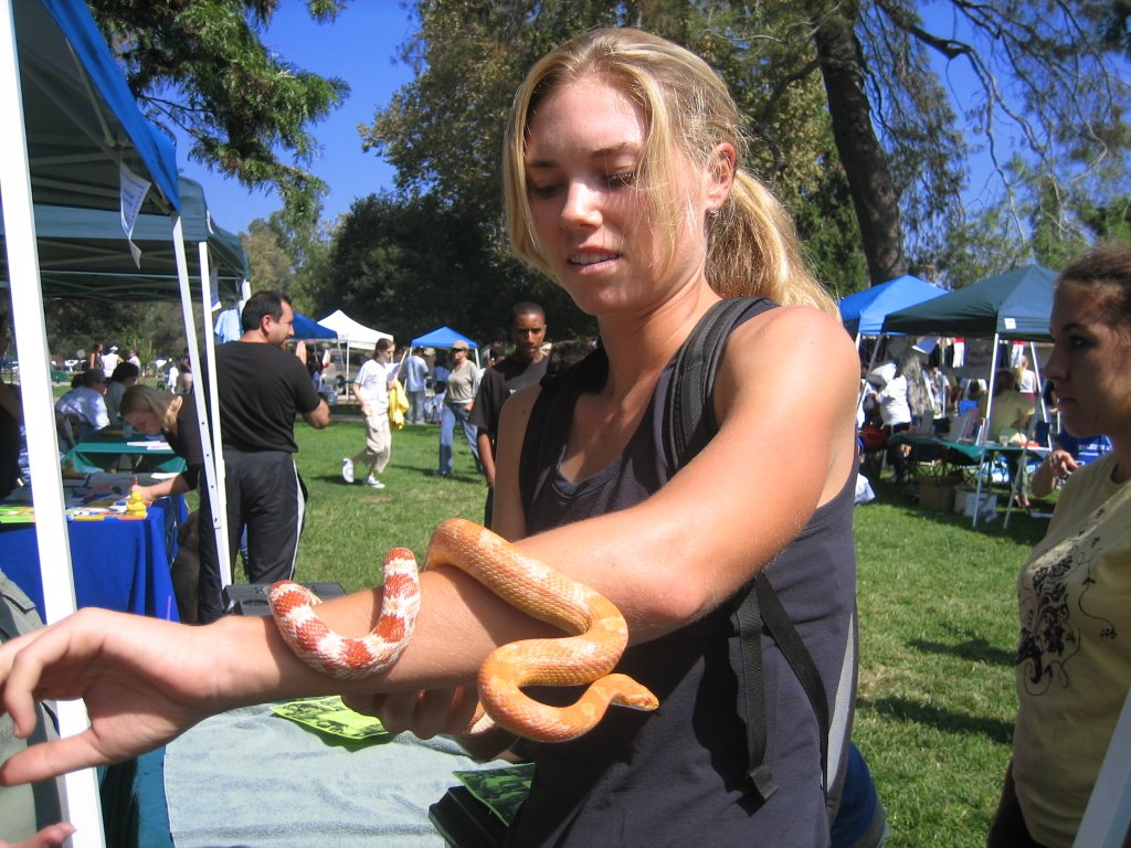
be that as it may, emma and anders made us feel right at home. anders tempered his aversion while bridget played with snakes in griffith park. emma took us in her car to some of L.A.’s prime spots, (it was our first non-hitched car ride in a year!) but tempered our culture shock by playing senegalese music on her car stereo. it was a pleasant stay, but for only three days back in the states, los angeles was clearly not the right city to break us in—and we think emma and anders agree. besides, the california coast alone was 1/3 the total distance of our trip, so we had to keep moving.
L.A. to carpenteria state beach
 we left west hollywood and made straight to the ocean, riding into a thick marine layer that was beginning to shroud the city of los angeles in a dense fog. back on highway 1 again, we cycled 27 miles of malibu coast, sandwiched between the beach and mansions perched on small hills. we were leaving the last of the southern california metro sprawl and happily heading for the more rural southern coast.
nearing the agricultural areas of port hueneme and oxnard we rode inland to the plains where huge fields of strawberries and lima beans flanked us on all sides. the weather was gray, moist and chilly—easily 50 degrees cooler than we were used to in baja.
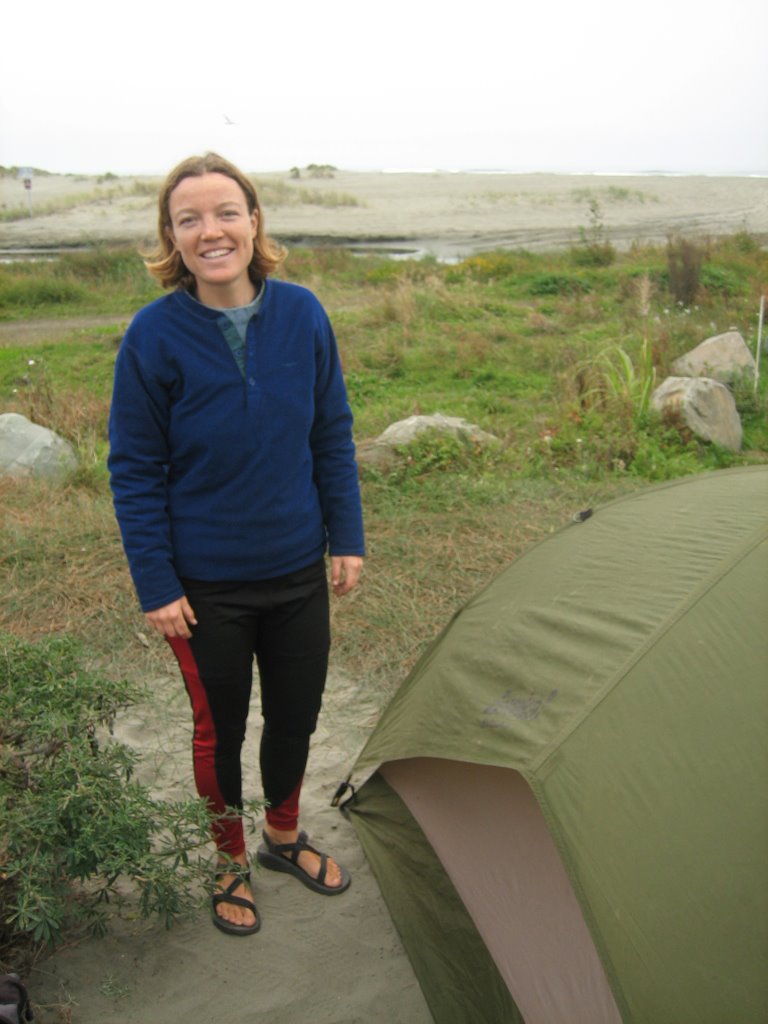
we arrived at carpenteria not knowing what to expect on our first night camping out in the states. all hiker/bikers are thrown en mass at one campsite (and in carpenteria this meant co-camping with some especially interesting characters), but the set-up is commensurate to the discounted rate and we were pleasantly surprised to find out that the state beaches and parks come equipped with all sorts of facilities and plentiful hot water, making camping almost luxurious. for us, the only thing missing was adequate sleeping gear, since coming from belize we had only bed sheets, which were hardly enough to keep us comfortable during the north american autumn nights.
carpenteria to lompoc

from carpenteria it was less than an hour’s ride to santa barbara, where we took a quick side trip to misison santa barbara, the tenth of the california missions established by the spanish franciscans. en route we ogled at city streets that were tiled (!) and residential streets that were immaculately manicured. already we were realizing the opulence of santa barbara when, on our way out, we took another side trip through hope ranch, a scenic hamlet with incredible houses set back along wide lanes ornamented with huge, thick palm trees. forget bike lanes—these roads had equestrian trails.
from the pastoral and scenic avenues of hope ranch we entered a fast and congested hwy 101 for some tense riding out of the santa barbara area. by midday we were back on a rural highway with less traffic, but a cold and thick fog was blanketing the coast. nearing gaviota we merrily turned inland and lunched at the rest-stop that was situated precisely on the far brim of the marine layer, where the clouds surrender to the sun. we took a long break, warming ourselves in the sunshine and preparing for a final push inland, up the coastal range and into lompoc.
the road to lompoc was a single hill, just shy of 1,000 feet but neatly laid out in a 2-mile straightaway that seemed almost indulgent after the “slopes of hell” we had traversed in baja. lompoc, our only interior destination, had been regarded by southern california natives as a sweltering strip mall with little of interest to the traveler. to us, however, the warmer weather and small town mid-western feel of lompoc brought on a calm after a first week back spent in the large metro areas of san diego and los angeles.

lompoc to san simeon
riding out of a coastal interior valley meant one thing to us the morning we rolled out of lompoc: hills. but as every great challenge is somehow rewarded, a scenic country road detour up and over the harris grade provided us with a much-appreciated tour of beautiful rural california.
a misty morning brought out the first of the fall colors in the red and yellow maple leaves lining the bends in the road. spider webs sprung a silver shimmer of light, shaken by rabbits darting into the bush. our summit of the harris grade was rather anti-climatic as we had a face-numbing, cold and wet descent to the flat and agricultural corridor of hwy 101.
on this morning we made it 30 miles before submitting to our desperate and growing need for caffeine and warmth, which we sought at a local gas station in guadalupe. nearly every stop we’ve taken so far on this ride has entered us into conversations with curious by-standers, but this stop brought about a most talkative and excited group of fellow cyclists. they were coming from the north (naturally), carrying no panniers (lazily), and taking part in an arthritis benefit ride (leisurely), 12 days from san francisco to los angeles. with well over half of our day’s distance still ahead of us (the equivalent to 2 days for the arthritis riders), we said goodbye and made our way back to the pacific, passing through the ever-popular pismo beach, morro bay, cambria, and reaching our night’s destination at san simeon state beach.
san simeon to big sur
the morning we left san simeon, a couple at the campground and longtime residents of the area briefed us on our day’s ride to big sur and beyond, romantically declaring we were officially crossing into northern california territory, hailed for its scenic ocean vistas, giant redwoods, and provincial landscape. but as they continued to describe towering and exposed ridges on a craggy and sloping coastline, their elegy turned almost foreboding.
“it’s a beautiful drive…[whistle]…but it will be one hellava trip on a bike.”
as if on cue, a gust from the santa anna winds blew through the pines and knocked over bridget’s bike.
L.A. to carpenteria state beach
 we left west hollywood and made straight to the ocean, riding into a thick marine layer that was beginning to shroud the city of los angeles in a dense fog. back on highway 1 again, we cycled 27 miles of malibu coast, sandwiched between the beach and mansions perched on small hills. we were leaving the last of the southern california metro sprawl and happily heading for the more rural southern coast.
nearing the agricultural areas of port hueneme and oxnard we rode inland to the plains where huge fields of strawberries and lima beans flanked us on all sides. the weather was gray, moist and chilly—easily 50 degrees cooler than we were used to in baja.
we arrived at carpenteria not knowing what to expect on our first night camping out in the states. all hiker/bikers are thrown en mass at one campsite (and in carpenteria this meant co-camping with some especially interesting characters), but the set-up is commensurate to the discounted rate and we were pleasantly surprised to find out that the state beaches and parks come equipped with all sorts of facilities and plentiful hot water, making camping almost luxurious. for us, the only thing missing was adequate sleeping gear, since coming from belize we had only bed sheets, which were hardly enough to keep us comfortable during the north american autumn nights.
carpenteria to lompoc

from carpenteria it was less than an hour’s ride to santa barbara, where we took a quick side trip to misison santa barbara, the tenth of the california missions established by the spanish franciscans. en route we ogled at city streets that were tiled (!) and residential streets that were immaculately manicured. already we were realizing the opulence of santa barbara when, on our way out, we took another side trip through hope ranch, a scenic hamlet with incredible houses set back along wide lanes ornamented with huge, thick palm trees. forget bike lanes—these roads had equestrian trails.
from the pastoral and scenic avenues of hope ranch we entered a fast and congested hwy 101 for some tense riding out of the santa barbara area. by midday we were back on a rural highway with less traffic, but a cold and thick fog was blanketing the coast. nearing gaviota we merrily turned inland and lunched at the rest-stop that was situated precisely on the far brim of the marine layer, where the clouds surrender to the sun. we took a long break, warming ourselves in the sunshine and preparing for a final push inland, up the coastal range and into lompoc.
the road to lompoc was a single hill, just shy of 1,000 feet but neatly laid out in a 2-mile straightaway that seemed almost indulgent after the “slopes of hell” we had traversed in baja. lompoc, our only interior destination, had been regarded by southern california natives as a sweltering strip mall with little of interest to the traveler. to us, however, the warmer weather and small town mid-western feel of lompoc brought on a calm after a first week back spent in the large metro areas of san diego and los angeles.

lompoc to san simeon
riding out of a coastal interior valley meant one thing to us the morning we rolled out of lompoc: hills. but as every great challenge is somehow rewarded, a scenic country road detour up and over the harris grade provided us with a much-appreciated tour of beautiful rural california.
a misty morning brought out the first of the fall colors in the red and yellow maple leaves lining the bends in the road. spider webs sprung a silver shimmer of light, shaken by rabbits darting into the bush. our summit of the harris grade was rather anti-climatic as we had a face-numbing, cold and wet descent to the flat and agricultural corridor of hwy 101.
on this morning we made it 30 miles before submitting to our desperate and growing need for caffeine and warmth, which we sought at a local gas station in guadalupe. nearly every stop we’ve taken so far on this ride has entered us into conversations with curious by-standers, but this stop brought about a most talkative and excited group of fellow cyclists. they were coming from the north (naturally), carrying no panniers (lazily), and taking part in an arthritis benefit ride (leisurely), 12 days from san francisco to los angeles. with well over half of our day’s distance still ahead of us (the equivalent to 2 days for the arthritis riders), we said goodbye and made our way back to the pacific, passing through the ever-popular pismo beach, morro bay, cambria, and reaching our night’s destination at san simeon state beach.

san simeon to big sur
the morning we left san simeon, a couple at the campground and longtime residents of the area briefed us on our day’s ride to big sur and beyond, romantically declaring we were officially crossing into northern california territory, hailed for its scenic ocean vistas, giant redwoods, and provincial landscape. but as they continued to describe towering and exposed ridges on a craggy and sloping coastline, their elegy turned almost foreboding.
“it’s a beautiful drive…[whistle]…but it will be one hellava trip on a bike.”
as if on cue, a gust from the santa anna winds blew through the pines and knocked over bridget’s bike.
before delving into the details of our most challenging day on the road, here might be a good time to add a quick fun fact about our trip.
fun fact: of the hundreds of other touring cyclists we saw riding the pacific coast highway, we were the only riders heading north.
any guide book on cycling the pacific coast will warn its readers, usually in the opening paragraph, that riding the coast south-to-north is highly NOT recommended because of coastal winds that consistently blow out of the northwest. our particular guidebook included with this stern warning teary testimonies of northbound cyclists who were brought to full halts, even on descents, by forceful
 santa anna winds. it is additionally warned that these winds reach raging gales by the fall and winter months.
 so there we were, heading north, in september, to big sur, known to get battered by wind and waves at any time of year.
twenty miles from san simeon we climbed our first 1,000 foot bluff, only to summit, pedal back down, and immediately climb a second 1,000-footer, a summit which was appropriately named ragged point. for another thirty miles (which would take us a record 5 hours!) we scrambled in and out of coves on a high, sloping, and abrupt road that offered us no protection from the 50 mph gusts that tore debris from the rock faces above us and threatened to send us swerving into the traffic. heading the other direction and with the wind, we saw a dozen day cyclists, light and free of panniers, sailing apace with southbound traffic; they had just enough time to glance our way with a mixed look of guilt and astonishment.
we made it to big sur but felt beaten and exhausted, and though we felt ourselves protected from coast, we barely registered that we were shielded from the winds thanks to a generous forest of stoic yet kind redwoods.
san francisco
“the coldest winter i ever spent was a summer in san francisco.” ~mark twain
we shared twain’s sentiment all too well as we made our way up the coast of northern california and to the bay area. luckily, our dear friend natalia came to the rescue by driving down from san francisco to pick us up at big sur, where we were still recovering from our wind whippings. ahh the wonders of car travel! converting days into hours, and thanks to natalia, we made it from big sur state park to san francisco in no time at all. getting a ride also enabled us to enjoy our surroundings in big sur a b
 it more that morning, and we used the extra hours to move about and explore the beauty of the park which we were too late and too tired to enjoy the night before.
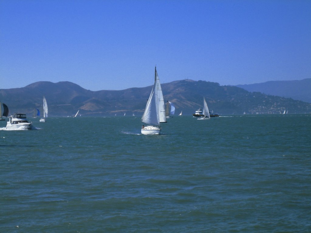
once settled in san francisco, we navigated the biker friendly city streets, visiting natalia where she sells stonehouse olive oil (try it!) in the ferry building before riding along the fishermen’s wharf and walking along the stretch of piers. the beauty of the city was in full force that day as a spinnaker regatta was taking place against a background of the bay bridge, alcatraz, and the golden gate bridge. in a city that presents visitors with a multitude of spectacles around every corner, we were thrilled to come across the sea lions at pier 39 as we made our way to crissy field and the foot of the golden gate bridge.

a relatively compact urban area, san francisco makes even a walk to the grocery store seem like an adventure. en route to golden gate park we braved the lower haight and took advantage of the numerous thrift stores in the area. in the park we moved about the many trails, trying to steer clear of the drum/smoke circles that seemed to loom around every corner; the park seemed to be a popular hangout for an eclectic troop of deadbeats.
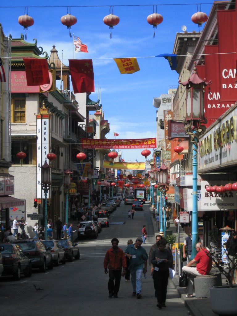
while our bikes were getting a last pampering at a bike shop before making their final push home, we took on the hills of san francisco by foot and set out for chinatown. after so much walking we took advantage of our surroundings and ate lunch at an inconspicuous yet well-known restaurant, where diners pass through the kitchen as they enter.
 a short train ride south took us to palo alto for an afternoon where we met up with dan rudolph, a family friend of the igoe’s from chicago. a tour of the stately stanford campus really hit home the disparity in educational opportunities in the united states and in belize, where not only do the majority not attend university, but even secondary school is an accomplishment and primary school is to be attended but not necessarily passed.
in addition to playing tourists, one of our main objectives while in san francisco was to “winterize” ourselves. after a stop at the goodwill on mission we walked out with: 1) an old-school, $8 sleeping bag (the type 1st-graders use at
 sleepovers and the type that definitely won’t compress to any suitable size, even when abby tries to sling the thing together with pieces of rope, AND it’s also the type that becomes 12lbs when wet, which why abby kept it wrapped, three times, in grocery bags); 2) a neon yellow, 100% polyester windbreaker by knock-off calvin klein; 3) wool socks, gloves, a sweater and a scarf; 4) a blanket. in one goodwill purchase we had successfully made the
 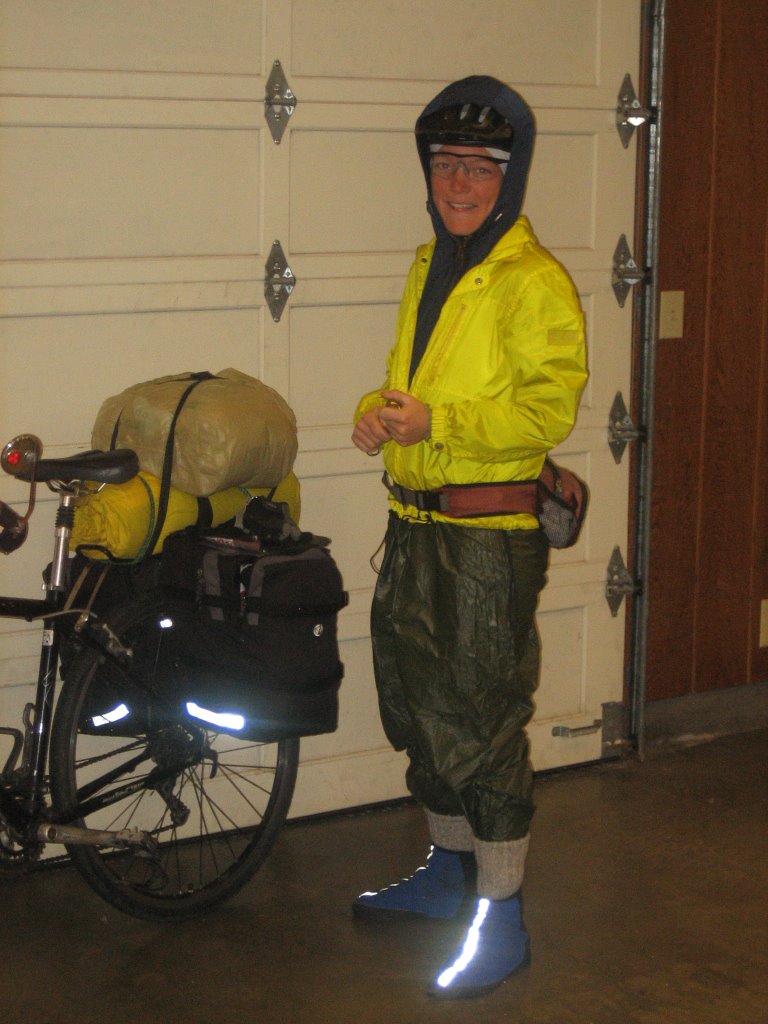 downshift from international cyclists to full-on transients (cum helmets).
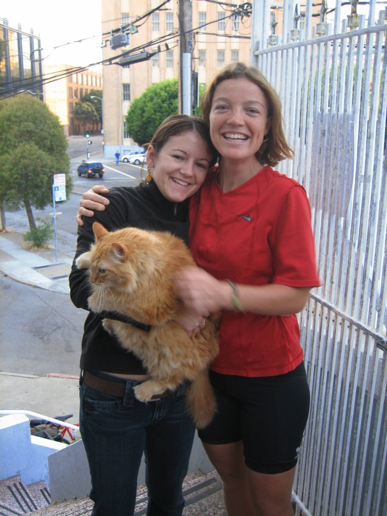
 having reunited with friends (bridget also braved her way deep into the mission to say hi to fellow evanstonian jay), knowing that transients are embraced by the city, and discovering where the best sushi in the city can be had, we thought about just ending our ride in san francisco and moving in with natalia and her beloved cats. but the need for trees persisted and abby insisted that we move on to oregon.
leaving the bay area
we left san francisco on a saturday morning, crossing over the golden gate bridge and riding through sausalito and the marin headlands with throngs of day cyclists out to enjoy the beautifully sunny weather of a fall day in the bay area. we rode through the shady samuel p. taylor state park and on to point reyes, where we lunched outside a bustling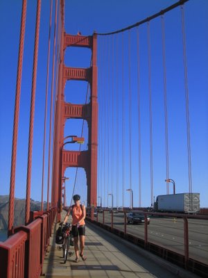 end-of-the-season farmers’ market. leaving point reyes we skirted 17 miles along the breezy tomales bay, studded with docks and restaurants advertising fresh oysters by the pound. at the end of the bay the road turned in toward the hills, where old farm houses and pastures were nestled into golden and sloping country. by late afternoon we were heading back to the ocean, riding against a strong headwind and with it a cold, misty air; we arrived in bodega bay to a shoreline and ocean comp
 letely lost in the fog.
we left san francisco on a saturday morning, crossing over the golden gate bridge and riding through sausalito and the marin headlands with throngs of day cyclists out to enjoy the beautifully sunny weather of a fall day in the bay area. we rode through the shady samuel p. taylor state park and on to point reyes, where we lunched outside a bustling
 end-of-the-season farmers’ market. leaving point reyes we skirted 17 miles along the breezy tomales bay, studded with docks and restaurants advertising fresh oysters by the pound. at the end of the bay the road turned in toward the hills, where old farm houses and pastures were nestled into golden and sloping country. by late afternoon we were heading back to the ocean, riding against a strong headwind and with it a cold, misty air; we arrived in bodega bay to a shoreline and ocean comp
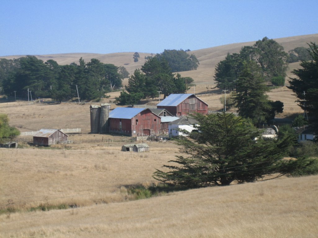 letely lost in the fog.
 that night we shared our hiker/biker site with 6 other touring cyclists, one of whom was nearing his trip’s end and, sad to see us in sandals, gave us his windproof, water resistant foot booties. abby hasn’t removed them since. it was frigid that night and we were lucky to have our new sleeping gear—and delighted to know our goodwill purchases would get us through the last two weeks on the road. we woke well-rested and warm but outside the tent everything was soggy from a coastal fog so thick with moisture it was as if we had spent the night in a deluge.
the ride to manchester state park began and ended in a cold, wet haze—a pattern we would know all too well during our northern california trek. on a 700-foot switchbacked climb we soaked up 20 minutes of charity sun (we were slighty inland), but we were only warmed enough to face the coast again, exposed to elements of wind and fog. it was back to riding the ups and downs of coastal bluffs, beginning and ending the day at sea level, but not before gaining and losing 5,000 feet en route. we rolled into the campground with the clouds, freezing, and there met an older canadian couple who were true veterans to the game of touring. we leered at all their simpl
 e, lightweight equipment and warm gear, especially in the chill of the early morning. the canadians, who woke after us but departed before us, cheerily waved goodbye just as abby was attempting to strap the bulky and awkward grocery-bag-wrapped goodwill sleeping bag to her pannier rack.
 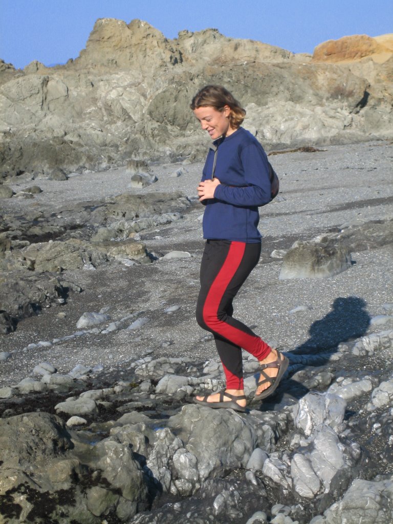 soon after the canadians, we left for our shortest and easiest day yet, a half-ride 39 miles to fort bragg, where we arrived by 11 am. after a luxurious stop in the safeway (we are grocery store obsessed and we think it’s because grocery store stops afford us our only time indoors!) we exited to sunshine, causing us to sit outside the safeway to bask in the sun over a two hour lunch. in mackerricher state park we spent the remainder of the lazy, sunny day picking loads of wild blackberries, exploring the tide pools, and scurrying from seriously large and aggressive squirrels.
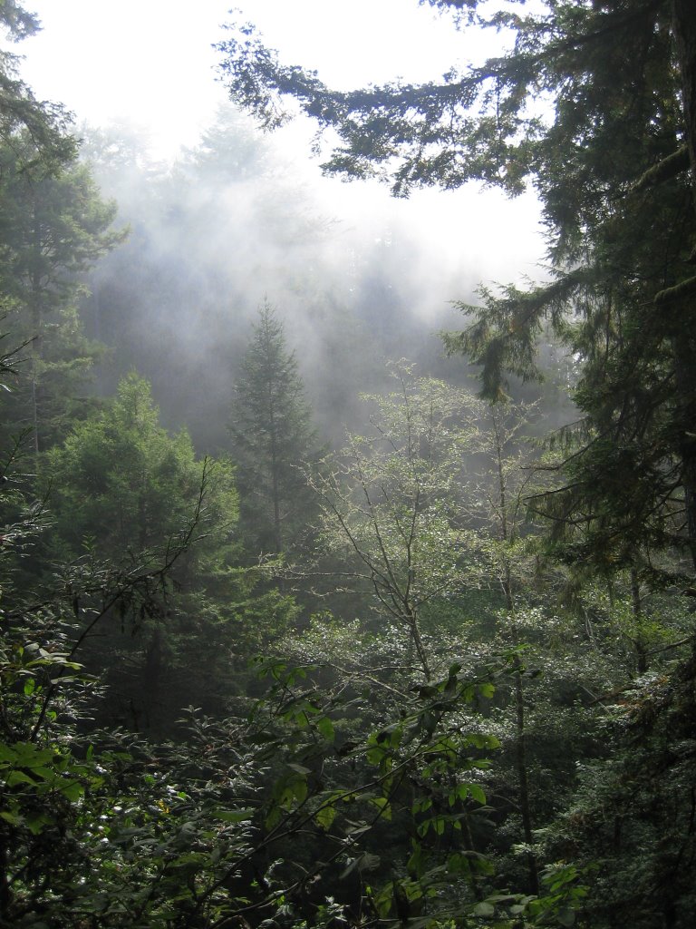
after feasting on blackberries for breakfast we set out to climb leggett hill, which, at 2,000 feet, is the highest peak on the pacific coast highway, and an especially considerable climb from the south. even before leggett hill was a 690-foot sampler, a warm-up hill which made sure to drop us back at sea level before we could begin the 9-mile, 2,000-foot ascent. for all its notoriety among touring cyclists, we found leggett hill a beautiful and pleasant ride, with a switchbacked, mannerly incline that allowed us to get in a slow and steady groove. the 4-mile descent was like flying amongst the trees but was, however, much too short; it dropped us at the town of leggett, where we ate lunch and re-supplied before making camp in the cozy pine-needles at standish-hickey state park.
avenue of the giants/humboldt redwood state park
our night at standish-hickey park was inland and the warmest night we would spend outdoors since leaving baja; it almost seemed strange to wake and get ready without shivering and we were happy to know we had another inland night ahead of us.
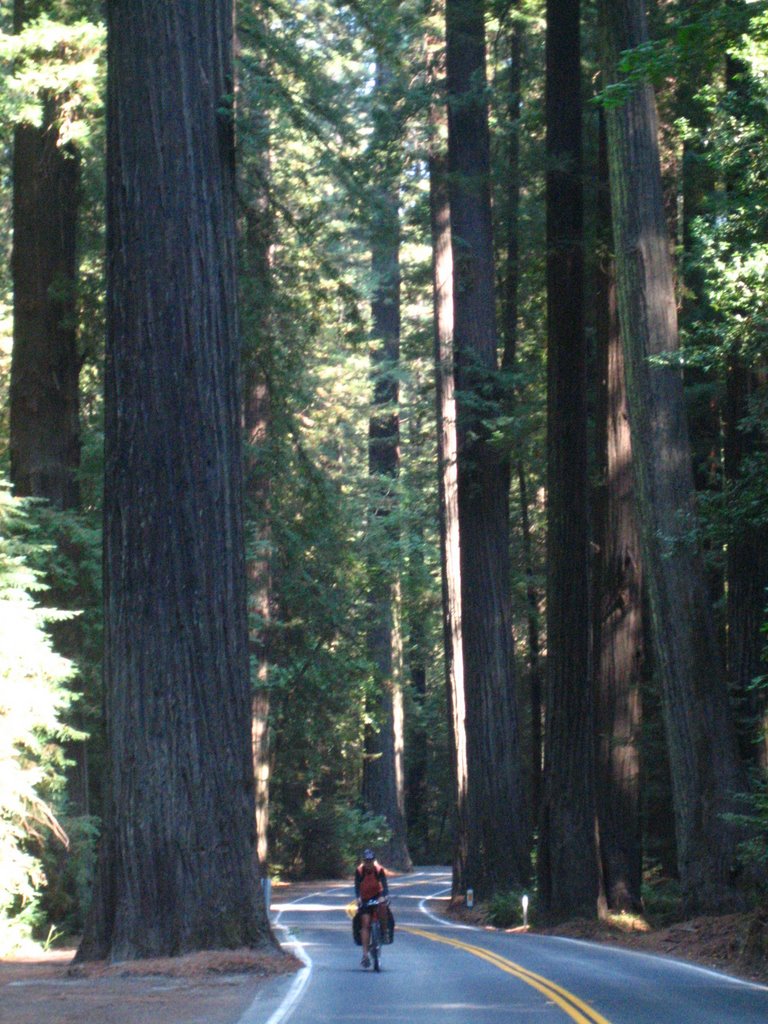
in the early morning we were joined on the road by three dozen or so fire trucks, all packed with firemen switching shifts at the nearby forest fire. nearing humbodlt redwood state park we exited hwy 101 for the avenue of the giants, an alternate scenic route that passes beneath the world’s tallest living trees, the coastal redwoods.
the coastal redwoods, which are confined to the narrow fog corridor of the pacific coast of california and southwest oregon, boast some amazing characteristics—towering at up to 370-feet with 22-foot diameters, a life span of up to 2,000 years, weighing 500-tons but growing out of a seed the size of a tomato seed, and impervious to diseases, insect damage and fire. but it’s hard to put i
 nto words what it’s like to ride, walk and sleep in
  the redwood groves, to be dwarfed from above and below by the world’s largest volume of living matter. wind, moisture and cold—elements we were daily laid bare to—vanished in the groves, absorbed by a foot of bark. our days in the trees were restorative ones.
the redwoods to clam beach
a night spent in the company of such amazing trees is a hard thing to follow up, and it is only pessimistically appropriate that the next night we shared a county campground with a parade of bohemian hobos.
leaving the avenue of the giants required a certain cooperation of muscle memory from our legs, for our hearts certainly did not want to be leaving the redwood groves. and so we pedaled out of obligation and habit, needing to move on, and we left the avenue to return to the rush of hwy 101. less than 10 miles later, nearing
 eureka, we were passing lumber mills and being passed ourselves by logging trucks.
 as we do in every city, we spent a couple hours hanging out in a grocery store (ahh the grocery store--that lovely, roofed, heated, sheltered room full of food) before heading to our camp for the night. clam beach was a trip back to the days of the merry pranksters, as bus-loads of psychedelically outfitted “families” walked around barefoot in the cold to the sound of drumbeats and the wails of their screaming, feverish children.
clam beach to elk prairie
a short, 30-mile day enabled us to reunite with the redwoods as we set camp early at elk prairie in redwood national park. en route we saw massive roosevelt elk lounging in the prairie grasses that flanked the highway, and at one point they were leisurely crossing the road, causing drivers and bikers alike to stop and stare at the grandeur of these huge, antlered beasts. a park ranger came to the rescue and, using his ford ranger truck, steered the herd of three off of the highway, allowing safe passage for all.
a short, 30-mile day enabled us to reunite with the redwoods as we set camp early at elk prairie in redwood national park. en route we saw massive roosevelt elk lounging in the prairie grasses that flanked the highway, and at one point they were leisurely crossing the road, causing drivers and bikers alike to stop and stare at the grandeur of these huge, antlered beasts. a park ranger came to the rescue and, using his ford ranger truck, steered the herd of three off of the highway, allowing safe passage for all.
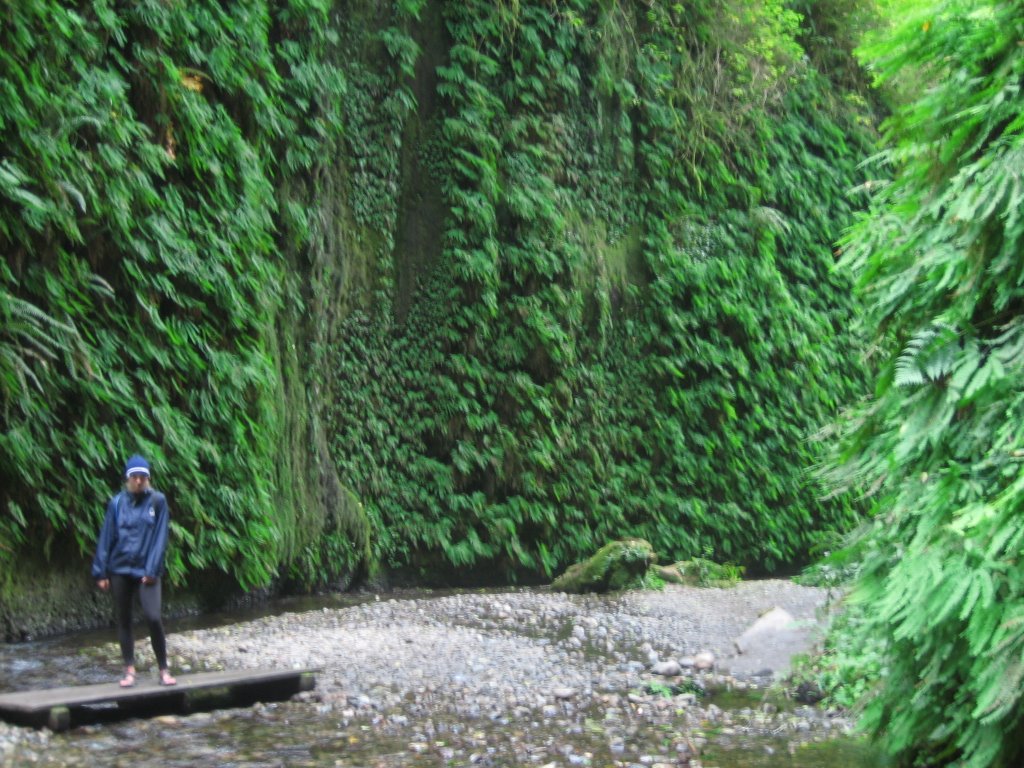
with the better half of a day spent off our bikes, we took a nine-mile round-trip hike to fern canyon. walking through grove after grove of redwoods, interrupted only by lush, temperate rainforest foliage, was a tolerable warm-up when we descended into canyon, where fern hung everywhere like green tinsel from the 40-foot walls.
elk prairie to harris beach…HELLO OREGON!
the morning we left elk prairie we had the satisfaction of departing before the other bikers, who were rightfully slow to wake in the damp chill of the morning. we, however, had a special pep in us despite the dark and cold for today we were advancing into oregon in what would be our last border crossing of the ride (bridget had been working on abby to continue the ride into canada, but abby was officially ignoring that possibility). so we headed out early, the sky still deep in dawn, and said goobye to our friends, the redwoods.
the morning we left elk prairie we had the satisfaction of departing before the other bikers, who were rightfully slow to wake in the damp chill of the morning. we, however, had a special pep in us despite the dark and cold for today we were advancing into oregon in what would be our last border crossing of the ride (bridget had been working on abby to continue the ride into canada, but abby was officially ignoring that possibility). so we headed out early, the sky still deep in dawn, and said goobye to our friends, the redwoods.
 an hour later in klamath, freezing, we stopped at a gas station to warm-up with a second breakfast in coffee and a shared “bear claw”, like a huge baked-apple strudel. forget energy bars—this warm, sugar-packed pastry kept us satisfied for hours, even as we plowed up two back-to-back 1,000-footers. for the rest of the trip, bridget traded in healthy protein bars for real sustenance as can only be found in the sweet goodness of baked or fried flour, butter and sugar.
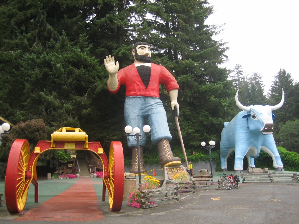
 descending our first climb (but still high on bear claw) we came to the trees of mystery, easily located by the larger-than-life figurines of paul bunyan (49 feet) and babe (39 feet) his blue ox, which together weigh 860,000 lbs. we stood by long enough to watch as a
 camera-ready man directed his wife to “hold ‘em blue balls of babe, babe” before we headed off to our second climb, another 1,000-footer with a cruel and unusual triple summit. down on the other side we coasted into crescent city, where a long-board surfing contest was in full swing.
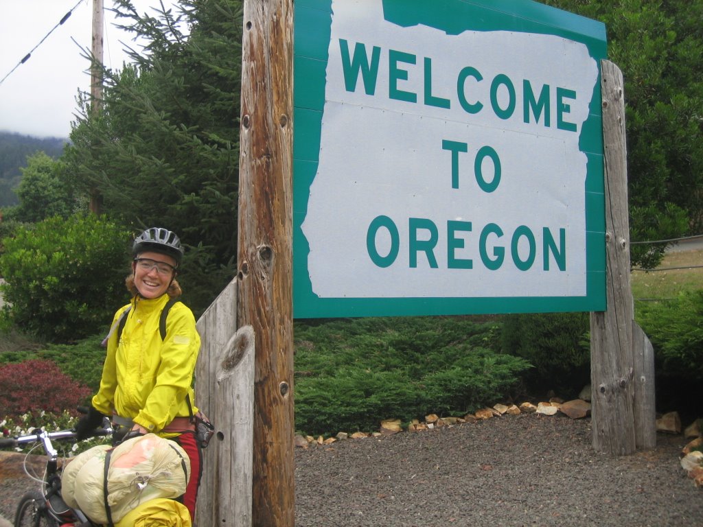
 we maneuvered through the busy city streets of california’s last major stop, but leaving the city limits we turned onto pretty and pastoral country roads for a final ride through california’s farming communities. taking shelter from a laundry-mat we ate a quick lunch just before crossing into oregon, abby’s beloved home state
 and where she has been away from for 3 years! only 5 miles north of the border and we had arrived to the popular harris beach state park, which even in the brisk, gray late-afternoon was busting with beach-combers and shore-strollers.
a hitched ride to the dunes
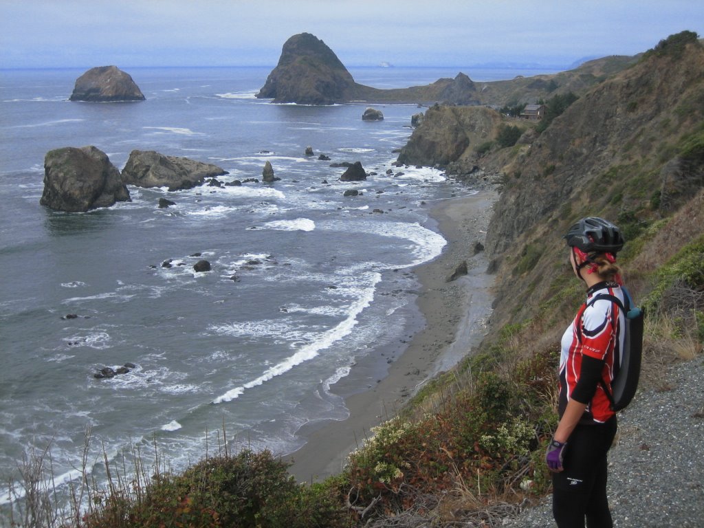
of all the 1,000s of miles we would ride on the coast, oregon seemed to us the most scenic and wild, with shores studded with a variety of haystack rocks, high and overhung capes, wind-sculpted dunes, and wide, open and deserted beaches that stretched on for miles. on our ride north from harris beach we were turning off the highway every several miles to peer off a scenic overlook at interesting rock formations or into the frenzied tidal waters of a cove.
in gold beach a sun that had not shone since fort bragg finally broke through the clouds and a delighted abby claimed she had once and for all proven to bridget that the sun only shines in oregon. (suspiciously, abby then ducked into a camping outfitter to purchase full-body rain gear, likely taking heed from the dozens of southbound cyclists who reported they never had a dry day in oregon).
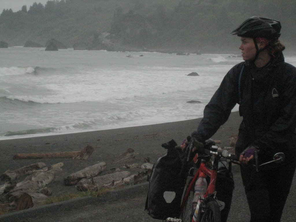
at strawberry hill we soaked up the last of a hazy (lazy) sun during lunch at a picnic area well-protected from the october winds. the day was moving along quickly until bridget snapped a spoke grinding up a tough incline. we were only 6 miles short of our destination at humbug mountain state park, but the broken spoke caused bridget’s back wheel to jam into her frame and prohibited any further forward progress until fixed. unfortunately, the break was on the cassette side and we did not have the necessary
 wrench nor an extra spoke to correct the situation. it was 3 pm and things weren’t looking good—it was cold and windy and a long way to push our bikes up a hill—but thankfully help did arrive with the friendly and funny zimmer couple from eugene.
 the zimmers loaded our bikes and panniers into their large, green pick-up (the mexican angeles verdes take many forms) and we headed north. first we stopped at coos bay but in some strange conspiracy all the bike shops were closed both sunday and monday. the zimmers talked us into “cheating” another 60 miles and drove us to jessie honeyman state park, suggesting we get the bike serviced the next day in the nearby town of florence, which is exactly what we did.
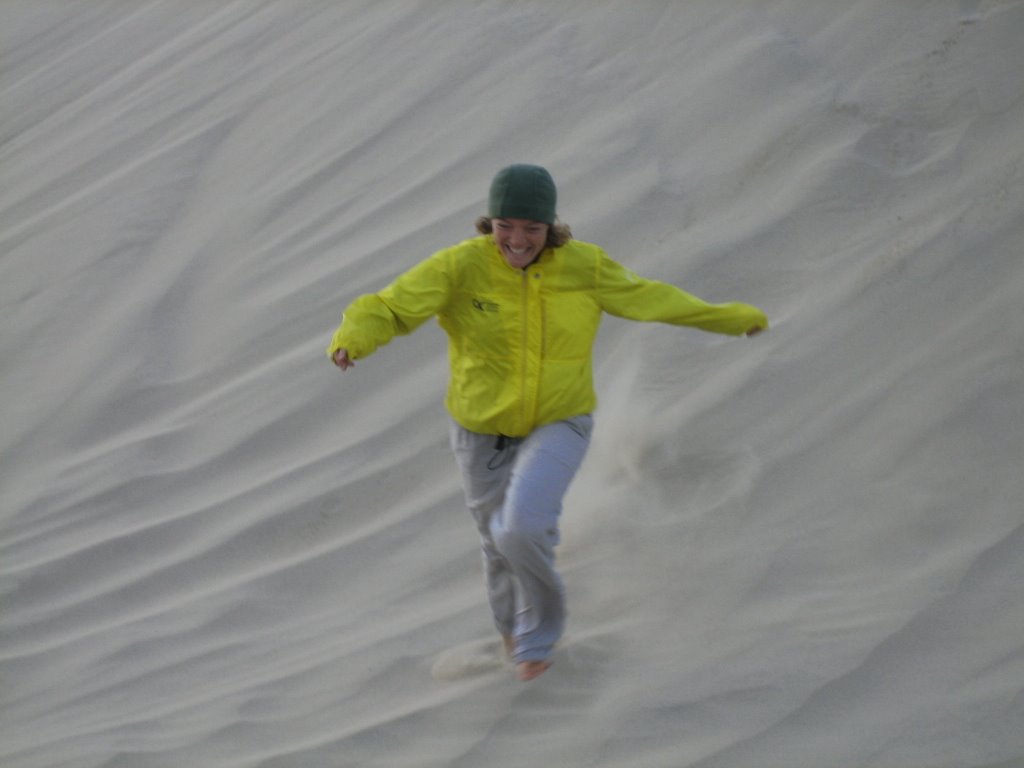
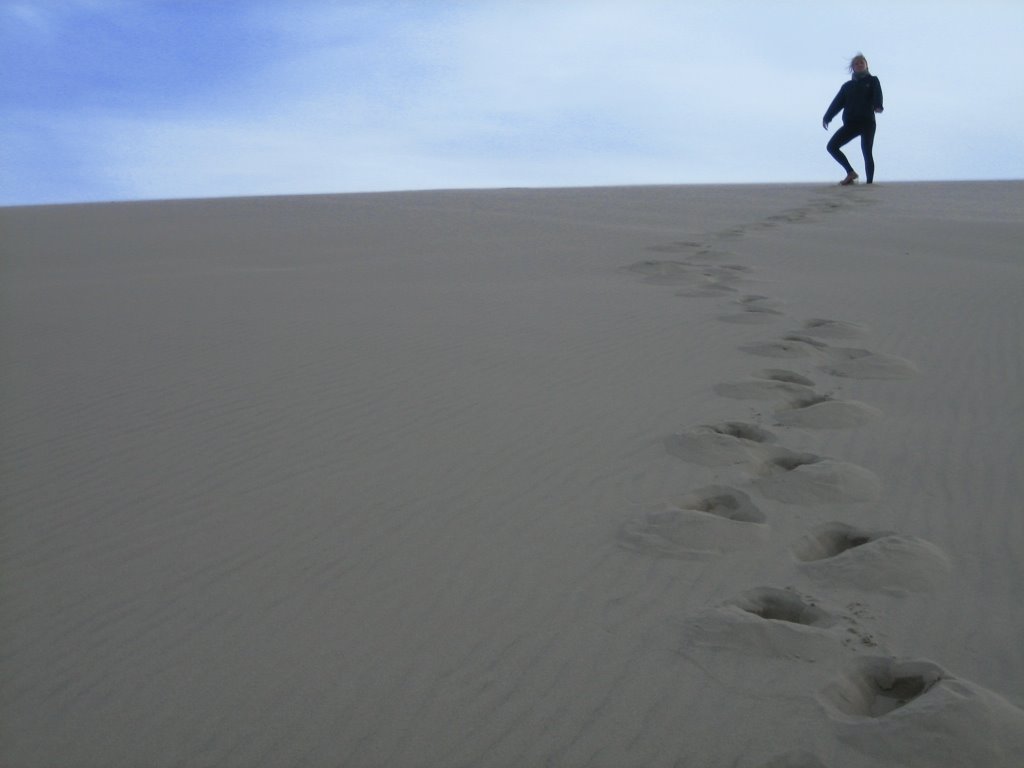
the following morning we took our first day off in ten days and bridget and her wheel hiked the 4 miles into florence to get a new spoke and the hub overhauled. meanwhile, abby cycled ahead to do our first wash since san francisco and to peruse the local grocery store. even after all these errands (and for bridget another 4 mile return walk), there was still time to play in honeyman park—one of the many access points to the 47 continuous miles of coastal dunes.
honeyman dunes to beverly beach
we left the dunes early that morning for an indulgent indoor breakfast of bagels and coffee at the nearby grocery store. with bridget’s tire fixed and our bodies well rested after a day-off, we set out, energetic despite the cold. our first detour of the day was 11 miles north of florence at the sea lion caves—the world’s largest sea cave. for a price, tourists can take an elevator ride down into the massive cavern, where herds of steller sea lions live year round.
 unable to fork over the cash we continued on our way, disappointed, when not ½-mile later we spotted some of the same sea lions from our high vantage point. off our bikes and hugging the edge of the high and gusty bluff we now saw hundreds of sea lions playing in the surf or lolling in the coves. it was quite the scenic overlook, with the sea lions below us and the heceta head lighthouse in the near distance. this time we continued on our way relieved we hadn’t paid the cavemen capitalists.
our ride to beverly beach never once strayed from the ocean, except maybe in terms of vertical distance when we cycled along high ridges or cliffs, or in the case of our traumatizing and lofty bridge crossing at newport (we’ll just leave this one at high winds, high-speed traffic and highly raging drivers). in yachats we each made the ever-important calls home—only this time we were confirming with all involved families our ETA in cannon beach. we were only three days away…
beverly beach to cape lookout
despite all the different terrain we would cross between dangriga, belize and portland, oregon, we would invariably define every day’s ride in one way—by their inclines. leaving beverly beach was no different and we set out early, knowing only one thing about the day: there would be three significant climbs.
at the top of the morning was the ascent of cape foulweather, which dropped us slightly inland and on our way to lincoln city. leaving lincoln city we passed the junction for hwy 18, which teased us with a sign reading 84 miles to portland. we chaffed at the thought of finishing our ride that day and continued north, intent on making it to cannon beach to meet our families and friends in 3 days.
 cascade head was our second climb. at the top, on a windy and brisk lookout, we stopped to layer ourselves in every bit of goodwill clothing we had and were accosted by a hyper couple from montana. it was their second day cycling—still in the honeymoon phase of their tour—and they were fresh and clean and in their exuberance only wearing shorts and jerseys. while they found our “snow suits” charming, we found their resemblance to the saturday night live spartan cheerleadersas (will ferril and cheri oteri) alarming.
 we left the bobbling montana couple and cruised down cascade head, passing a housing development construction site in neskowin, and over the nestucca river, where people lined the banks fishing for salmon heading upstream. in pacific city we stopped for groceries and ate a picnic lunch on the beach at cape kiwanda, the first cape in the three capes scenic loop, where another major development crew was bulldozing the beach, right along the state park line, for the construction of time shares.
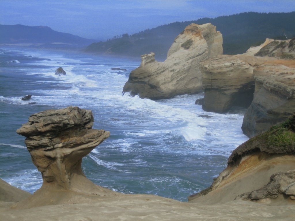
after lunch we left the bulldozers to explore cape kiwanda, where steep dunes led us to sweeping and spiraling sandstone structures. riveted, we stood on the cape’s edge for hours and watched as careening tidal waters rolled and surged up onto the cliffside, continuously sculpting and reshaping its malleable walls.
in the late afternoon we rode off towards cape lookout, our third and toughest climb, our legs wasted from hiking the dunes at kiwanda. the road was pretty with the golden hue of an evening sun casting through birch trees, but we were tired. we paused at the top to take in the view of netarts bay, split down the middle with
 a thin peninsula, but didn’t stay long because we were eager to get to our campground, an easy 3-mile sail down the other side of the cape.
cape lookout to nehalem bay
we couldn’t have asked for anything more on our ride to nehalem bay, the last full day of our long return from belize. th
 e morning began with a beautiful and meditative sunday ride along netarts bay, where the only traffic along the road were blue herons. we took an early break at oceanside to explore the beaches on either side of the tunnel at maxwell point, and to try and spot the murres and puffins that make their homes on three arch rocks.
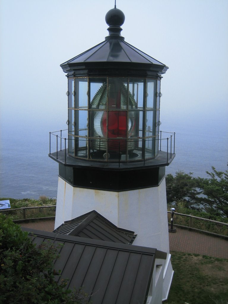
we sped up cape mears, the last in the three capes loop and took the steep detour to visit the cape mears lighthouse, famous for its first-order fresnel lens, a french design which used prismatic elements and multiple plates of glass to project and magnify light. also on cape mears we saw the octopus tree, a sitka spruce which has
 grown horizontally due to the high velocity winds on the cape.
 down from cape mears we raced towar
 ds tillamook, tracing the southeast slant of the tillamook bay and riding WITH the wind for our first time since crossing over to baja (for the record, that’s 2,000+ headwinded-miles ago). clocking 20 mph, we arrived in tillamook officially hating every southbound cyclist (for the record again, that’s every cyclist).
 we tempered ourselves, northbound wind-warriors that we are, with a tour and tasting of the tillamook factory.
energized from cheese curds, a vat of pumpkin ice cream, and sunshine, we hit the road again for the last stint of the day. traffic was heavy but slow, as everyone seemed to be enjoying the late afternoon sunshine and the gorgeous scenery of the
energized from cheese curds, a vat of pumpkin ice cream, and sunshine, we hit the road again for the last stint of the day. traffic was heavy but slow, as everyone seemed to be enjoying the late afternoon sunshine and the gorgeous scenery of the
small fishing hamlets around nehalem bay.
 we arrived at nehalem bay state park and set up camp for our last night on the road. it was oct. 5th, almost exactly 3 months since we left the southern coast of belize, and now we were on the northern coast of oregon. it was only 13 miles to cannon beach, the end of our ride.
the last ride (well, not technically…)
the morning of our last ride, as if to convince us we wanted to be finished with this trip, the weather woke us with a cold and unkind rain. always prepared for such dirty tricks, we moved our camp into the park conference hall where, under the cover of a dark morning, we quietly carried out our routine in the comforts of the dry indoors. by the time we were set to leave, the rain was only proving its persistence. it appeared we were going to finish this thing the same way we began it—in a downpour.
fateful optimism is a fine outlook to embrace, but it surely won’t keep you warm, and this frigid oregonian deluge was nothing like the tropical bath we had on our first day back in the yucatan. but the ride to cannon beach was only 13 miles, a mere fraction of the 4,300 miles it took to get to where we were, so we layered ourselves in every bit of goodwill we had and went for it.
cannon beach


we might have been a little too earnest in overcoming the rain and cold that morning because we arrived in cannon beach before the welcoming party, and without access to the hunt's beach house. we didn’t have to wait long and bridget’s parents bill and kate, the first non-bikers to arrive, met us within the hour. the rain was beginning to let up so at the suggestion of the eager mid-westerners we took a drive to astoria to see where the lewis and clark expedition ende d--where the columbia river meets the pacific ocean.
 d--where the columbia river meets the pacific ocean.
 that night bridget’s parents took us out to eat and sat by in awe as we each consumed a three course meal, plus their leftovers, plus desert. abby’s father and kathleen, his girlfriend, arrived later that night,  completing the first round of family to witness us in good health.
 completing the first round of family to witness us in good health.
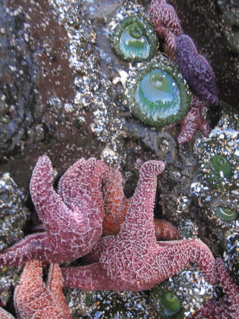
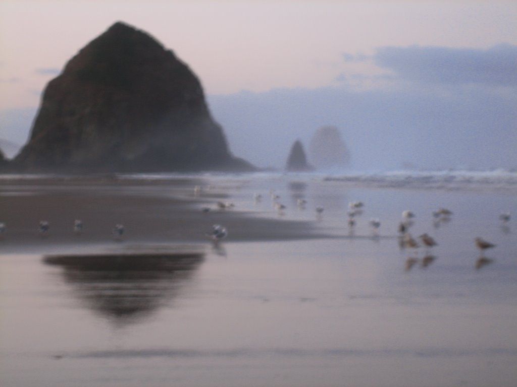
 in the morning we roused everyone early and took a stroll on the beach to see haystack rock and its surrounding tide pools. it was low tide and the base of haystack rock was alive with sleepy starfish, abrasive barnacles, firm mussels, and blooming anemones, all clad in rich and regal colors of purple, orange and green. the day was sunny and clear, almost balmy (even for those with belizean blood), but when incoming tides flooded the base of haystack we moved on to ecola state park for a short hike to
 indian beach, popular among surfers.
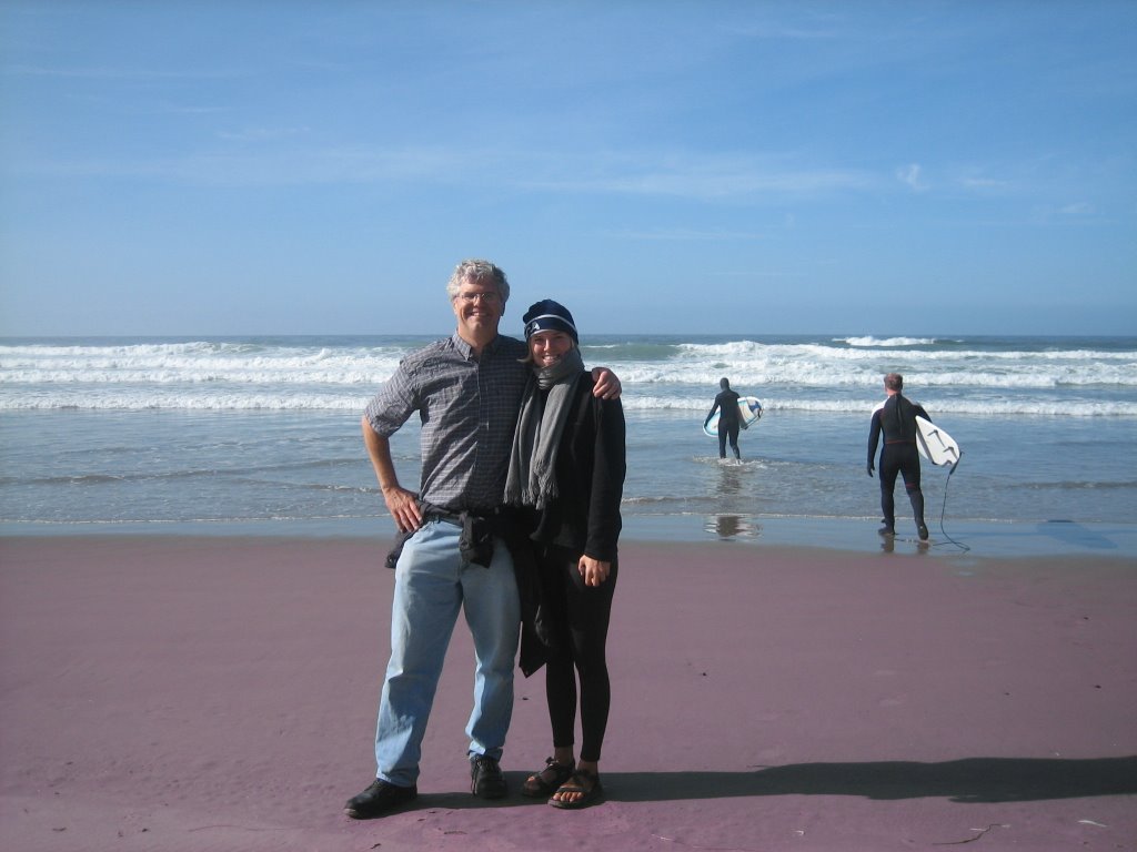
by the afternoon, abby’s uncle tony and his children, cubby, sid, and scalley, had joined us, as well as bridget’s childhood friends courtney and becky, officially completing the party. taking cue from the surfers, bill and abby took the plunge into the pacific, sin wetsuits; a far less exhilarated bridget put in her time as well, but only for mr. hunt’s famous 5-waves-for-a-candy-bar deal.
the welcoming party broke up in almost the same order it came together, and though it was a short reunion, we can’t thank everyone enough for taking the time to see us through the last leg of our ride. once the rental SUV, ford explorer, station wagon, and the vehicle with heated seats had pulled out of the driveway, ALL heading for portland, we frantically looked at each other and thought: “ but ho
 w do we get home?”
our official last day on the road was the ride from cannon beach to portland, leaving the coastal highway for good and crossing over the coast range. it was a beautifully clear day and approaching the coast range summit (1,650 feet) we could the peaks of mt. hood, mt. st. helens, and mt. adams, all from one viewpoint. we surfed down the coast range and into the corridor between the north plains and tualatin valley, where a fast and flat straightaway took us to the hunt household in oak hills, portland.
and that was that.
a belizean beginning and a belizean ending: the vote of thanks
in belize, every event ends in the same way, with a vote of thanks calling out all those who made the occasion possible. in this spirit, we would like to thank:
belize where it all began…
all the friendly strangers especially the tollroad medicos in oaxaca; manuel from san ignacio; manuel from mazatlan; the truck driver gregory; the angeles verdes; the bomberos of leon; will’s mother in zacatecas; the environmental scientists from ensenada; the bootie guy named guy; the zimmers of eugene; and the countless others
the friends and family that supported us along the way nicole of san fran/corozal; tina and ray of pacifica; the yelich’s; uncle bill; emma and anders; natalia, kerri, val and sid; bridget’s mom and dad, kate and bill; abby’s dad larry; kathleen; tony and company; becky and courtney; and all those who wrote comments and encouragement along our way, especially mike, terry and tony
our sponsors bruce sanchez of belize city and some stateside biggies that prefer to remain anonymous
food vendors which we really couldn’t do without market ladies everywhere, but especially in oaxaca!; rotisserie men; helado de michoacan; bodegas; panaderias; and bottled water (why, oh why didn’t bridget drink more of you?)
.
posted by Bridget Igoe and Abby Hunt at
11:40 AM
![]()
![]()

1 Comments:
Wow - - - - that's some serious biking. Your photos are unbelievable!!! I LOVE the tide pool.
I found you through my site meter, and since I am new to having a site meter - - - - I'm finding it MIND BOGGLING that unknown people from so far away, could "find" my blog, even more mind bloggling - pun intended - that they would WANT to. How did you do that?
Kind of a rhetorical question.
By Keetha Broyles, at 8:43 PM
Post a Comment
<< Home